
Doi Pui Trek
A one-day trek from Chiang Mai to the summit of Doi Pui
Doi Pui mountain overlooks Chiang Mai and is just asking to be climbed. I was in Thailand with a large party from all over the world - members of the Sri Chinmoy Centre primarily there to practise meditation - but among the group were lots of keen runners and trekkers who were exploring the local hills whenever an afternoon became free. For Doi Pui, I spent ages trying to find info on a walking route to the summit and was really surprised by the lack of info. Apparently you're supposed to drive up to a spot near the top and come down on a hired mountain bike wearing full body armour. That's great - I'd love to - but when I look at a mountain I find myself wanting to start at the bottom and get to the top on foot before I start thinking about taxis, bikes and all that stuff. Eventually I found a great 1:50,000 map with contours and most roads marked on it, and even some of the trails. Some guidebooks tell you that the summit is off-limits because of military activity - as of Feb 2007 that certainly wasn't the case! If you want the map, and it did prove useful, try the Suriwongse bookshop just a few blocks east of the southeast corner of the old city.
We began our hike - myself, Amalendu from Oz and Frank from Holland - at the Huay Tung Tao reservoir northwest of Chiang Mai (just a half houur drive from town). A highway encircles the lake and there were some very hot cyclists lapping it at speed on mountain bikes. We jumped out on the dirt road on the peninsula that juts out into the lake - there is a public restroom here and a few stalls, and seems to be the usual drop-off point for the taxis. Once we'd sorted our packs and got the sun protection on, we walked back out to the lake's ringroad and took a left, looking for the trails with the help of a rather sketchy map. Basically, if you look up at Doi Pui and just follow your nose, you should find your way through the maze of little tracks to the main dirt track up the mountain.


We were there in the (very) dry season as you'll see from the pictures, but the forest was still very beautiful and varied and in places still brilliantly green despite the lack of rain. The trail wound upwards onto the hillside and we took narrow offshoots to the left whenever we could - we were looking for a hiking trail that heads off that way straight towards the summit (whereas the dirt road takes a more circuitous route) but each time the path rejoined the dirt road, so we found ourselves going the long way round.


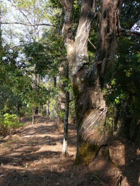
Shortly after the farm shack (pictured) we enjoyed some great views both down to the reservoirs and up towards the ridge. The path divided and on instinct rather than mapwork we took a left (seen as a sharp turn south on the google map below). Had we gone right, we would have stayed on the main dirt road marked on the map. The left followed the contours heading south along the hillside - wild in places, but with much of it cultivated, the hill country was very serene (a word I couldn't help using a lot in Chiang Mai!) and lovely. One or two locals on mopeds past us coming down - these narrow dirt roads are the only highways in these hills and they certainly aren't the preserve of walkers. I was getting unsure of our position and worried that we might have to backtrack all the way to the fork where we had taken a left, but a party of mountain bikers came sailing down past us, one pausing long enough to confirm that they had come from the summit area and if we kept going we would be OK.
Our next meeting came at a crossroads, where two locals were sat chatting with their motorbikes laying under the tree beside the trail. The pointed to the up-hill track and said "see nay roo" or something similar, and when I found "Priest Camp Site - Si Ne Ru" on the map it confirmed where we were. Si Ne Ru is a village on the dirt road that heads to the top of Doi Pui from the east - we had taken a route that didn't exist on the map, but had come the right way nonetheless.
Later when we rested under some pines for lunch we met a local dude in a bandana on a trials bike who stopped and held a conversation with us with his dozen or so words of English. This was enough for us to get onto spiritual topics as two of the words were "God" and "Buddha". "God yes, Buddha no?" he asked us. "God yes, Buddha yes, same same" was our attempt to convey an accurate answer, and he seemed to get it. He seemed to like us, and we him, though I couldn't shake the feeling that he had appeared as an extra in Apocalypse Now - maybe it was the jungle setting and the kakhi bandana?


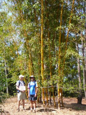
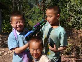
On arrival at the ridge, after a steep climb through what were now mostly pine trees as we had reached the higher ground, we found a monastery and some superb bamboo forest. The latter prompted lots of chatter about scenes from Crouching Tiger Hidden Dragon, but none of us was brave enough to climb up Li Mu Bai style. There was no-one around at what was presumably the "Priest School" on the map, but we soon found ourselves wandering into the hill tribe village of Si Re Nu where local kids were keen to put on a series of power-ranger poses once they saw we had a camera. Most of the villagers seemed to be gathered in a simple wooden church - proof that God and Buddha are both to be found on this mountain.

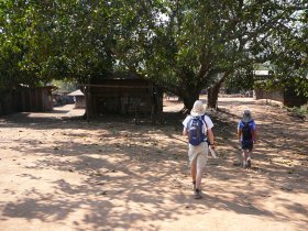

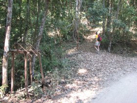
Taking the track through Si Re Nu, and out through the gateway pictured, we took a right on the sealed road that skirts the summit area. All that remained was to hike along this road to the other side and find the track leading up the ridge to the summit from the north. Then we spotted a track (next picture) that seemed to be on a bearing straight to the top so we took it and sure enough found ourselves on the beautifully forested ridge. These last couple of KMs are the most tranquil, most beautiful and also some of the steepest on this route - a nice way to finish the climb.


Although it was hazy as usual we had nice views through the trees to either side of the narrow ridge, and could make out Doi Mae Sa to one side and the Chiang Mai Valley to the other. Once at the summit we posed for a timer-shot with all three of us before taking the nature trail signposted "Doi Pui Camp Ground" which led us through some quite dense forest with ladders in places that helped us get over tiny gulleys and fallen trees.


Once down to the view point and camp ground, we came out on to the highway (or should I say the narrow winding lane) and made for Doi Suthep. It was getting late, and we all had stuff to do tha evening that required us to be back in Chiang Mai at six, so we were quite glad after nearly an hour of fast walking on the undulating road when a van pulled up and we were offered a lift sitting in the back on a pile of wooden panels. The lift was just a short ride to the Royal Palace but here we were able to haggle for a taxi and get the rather airsick ride down the hairpin bends back to the city.
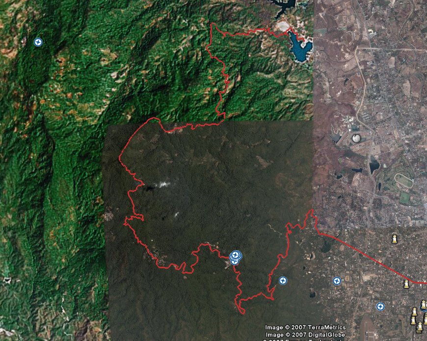
Google Earth Profile of Doi Pui Trek
Summary Data Total Time (h:m:s) 7:13:18 14:07 pace
Moving Time (h:m:s) 5:53:07
Distance (mi ) 30.66
Elevation Gain (ft) +16,860 / -16,984 (this includes the tiny ups and downs - really we climbed about 6000 feet but with lots of minor ascents and descents on the way)
Temperature (°F) 88.3°F avg. 91.4°F high
Wind Speed ( mph) E 5.1 avg. E 11.5 max.
Detailed Trekking Map of Doi Pui are - 2 meg file
