MYNYDD MARCHHYWEL
It looked so easy, both on the map and when I arrived at the foot of this forested mountain just north of the heads of the valleys. The map did show that the entire top was densely forested and criss-crossed by a convoluted network of forestry tracks though, so I knew finding my way might be difficult. And it turned out to be a real challenge.
I parked at Treforgan and headed up a public path into the forest. Soon it became clear that there were many tracks and paths not marked on the 1:25000 map, and all the paths were curved, following contours and irregularities in the shape of the hill, as well as meeting the needs of the forestry itself. Soon in rain and mist, surrounded by trees packed so dense that going off the trail was impossible, I was semi lost and struggling to make use of the compass in terrain where you can't take a bearing to a feature (as you can't see any) and you can't run on a bearing (because you are in a forest and have to go where the tracks and paths go).
I ran down several tracks that turned out to go the wrong way - curving back on themselves after perhaps a quarter mile of running. This got tiring and was bordering on frustration, but this 40 summits thing is supposed to be a challenge, right? So I kept at it. I tried taking smaller paths that seemed to head in the right direction - they led into deep bog, were blocked by fallen pines that had to be climbed over or "tunnelled" under. It was so wet in places that at one point a pair of Mallard ducks swam across the track in front of me. My legs went shin-deep into the mire. My ankles were sore already. Eventually, after so many false trails, I came to a north-south track wide enough to offer a bit of a view - I looked north and saw the object of my quest peeping through the mist - that must be Mynydd Marchywel - right?
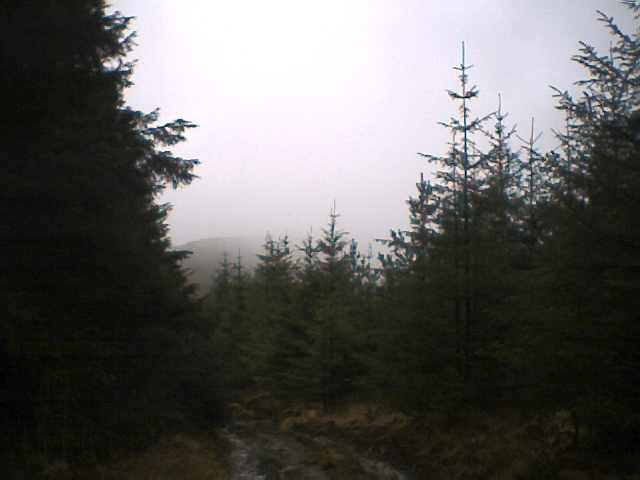
As the photo shows, it was a pretty vague sighting. Still, it gave me some hope and I ran onward in search of the elusive mountain, who was obviously keen on hide and seek. The game wasn't over yet though. Even when I arrived at the foot of the main ascent, with a clear view of the mountain itself, the way ahead was so densely forested that I took a forestry track that ran around its base, hoping it would lead to a clearer way up. Indeed it did, but not until I had run about a mile further north than the summit. Then the climb led me to the clear end of the hilltop, and I came to the edge of the forest. The map showed that the summit was marked by a trig point deep inside the trees, and instead of one path leading in, as per map, there were three overgrown trails. I took one, and soon found it heading back downhill. I took another, and found it so overgrown that I had to force my way between tightly packed pines. After several minutes I came back out into the clear ground - a hundred or so metres from where I had started. The third proved to be the right one - I was so glad to see that trig point, 85 minutes after starting out.
The way down proved no easier - I ended up a mile north of the car and had a trek back along a hard road. I'd been out for 2 hours and fifteen minutes by the time I collapsed back into the driver's seat. Never underestimate your opponent :) Still, I'd had to dig deep for a bit of patience, and a bit of endurance (even the return journey had involved quite a few climbs) so I felt well "tested" by the end. A good day out, if not exactly accccording to plan.....that had been my second mountain of the day, but the first and third were very easy. Thankfully.