MYNYDD EPPYNT
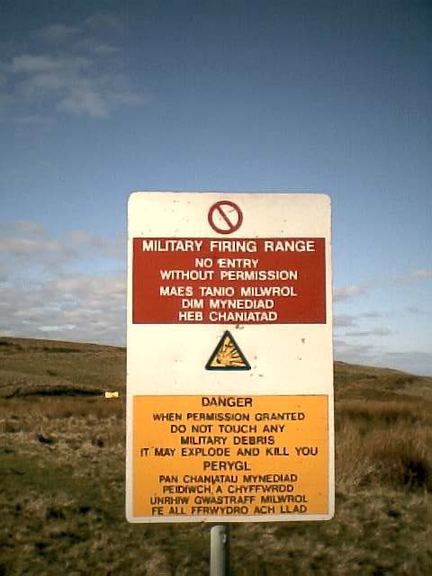
This mountain was the most distant from my home of my list of "40 highest mountains in South Wales" taken from the TACIT tables. The actual spot height has no name of its own - Mynydd Eppynt refers to a vast area a bit like Dartmoor - undulating grassland punctuated with peaks, ridges, streams and bogs, with a steep escarpment to the north. The highest point is close to the road - probably a five minute jog up and back - so I was planning to approach from the north side to make it a decent hill run. In the event, after two hours driving, I arrived to find the red flag flying which meant that if I strayed off the road I was liable to be blown to bits by friendly fire. This area is used by the army for tank and artillery practise. You can see small two-dimensional tanks looking like cardboard cutouts dotted around on the hills.
So, grateful to have caught some nice views, but disappointed to have to miss one top off my list, I headed back south and decided to add the rather higher mountain called Y Gyrn as a substitute to the 40 summits. This one didn't originally appear on the list as there is not sufficient drop in height between its summit and the slopes of Corn Du to make it qualify as a mountain in its own right - but as I needed a 40th mountain, I wasn's going to complain about such a technicality.

The sign says "LIVE IMPACT AREA".

Mist rolls up top the scarp of the Mynydd Eppynt like the sea coming in....