BANNAU SIR GAER
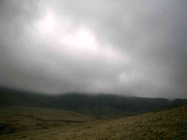
This was the mountain I'd hoped to climb after Fan Hir and Fan Brycheiniog, but on that occasion the weather had forced me to turn back. On second attempt, two days later, it was raining but the wind was not so extreme. Cloud was low - much lower than in the picture when I started out - and I'd spent a long time getting there because of the fog-bound roads over the Black Mountain.
I parked by the stream running down from Llyn Y Fan Fach and as I was putting my shoes on four soldiers with rifles wandered past. I guess its an everyday sight up here, but a strange one to me. I ran up the track towards the lake - soon finding myself in thick fog/cloud and blustery drizzle. There was no view at all of the mountain ahead of me, but I found the path at the lakeside (too foggy to see the lake though) and headed up on to the ridge. I was jogging at a steady pace on the climb, and was on Waun Lefrith (a mountain in its own right on the map, but not on my list) in about 35 minutes. Then it was another ten minutes of undulating through the cloud to the well-marked summit of Bannau Sir Gaer. The path, like so many in this area, hugged the precipitous cliff edge, but the wind was not so strong as to make it unsafe.
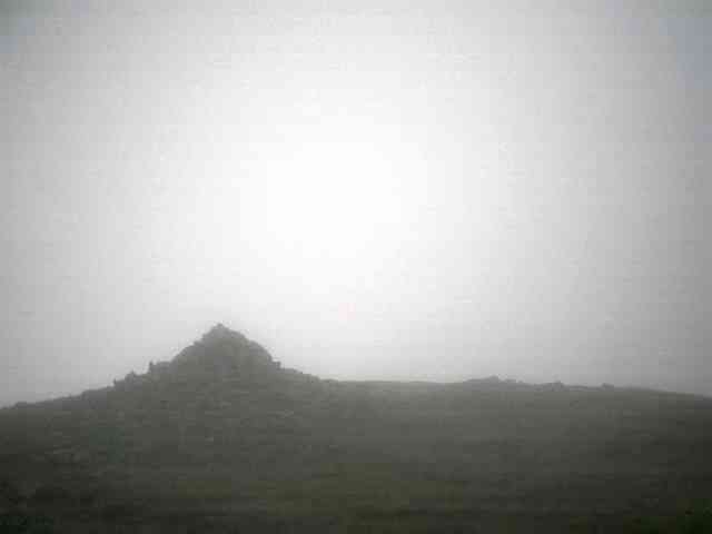
Thats the summit cairn of Bannau Sir Gaer from a few yards away - and a great view of the inside of a cloud.
GARREG LAS
The next leg of my run was going to be harder - from Waun Lefrith, ten minutes back from the summit of Bannau Sir Gaer, I headed west on a compass bearing through the murk. There were no features to follow, no path, and zero visibility. I was soon in a nowhere land of marsh and braiding streams that divided and rejoined in a random pattern that made for very wet feet. I followed the larges stream, thinking it would be the one marked on my map, but when I came down out of the cloud I found myself way too far south. But when that cloud did lift, wow, what an incredible view. In all my wandering on the English mountains I've never found myself so far from any sign of the influence of man - here on Black Mountain, I found myself in the middle of an amzing, desolate vastness. Ahead of me a lively river ran through a gulley, then meandered across a plain flanked by looming mountains, their tops in the cloud. This went on as far as my eyes could see - rolling, marshy plain, rivers and streams pouring from the mountainsides....this place had that wonderful primordial feel - Eden-like even.
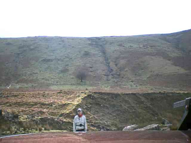
Still, that winding river had made me realise I was lost as it was flowing roughly southwards and that meant I had followed the wrong stream from Bannau Sir Gaer - I worked out a new route and headed north over some low, boggy ridges until I found a hint of a path - following this I struck lucky as it soon broadened into the major trackway I was hoping it to be - which runs north-south across the Black Mountain roughly from Llandeusant to Ystradynglais. I took the path northwards until it crossed the Twrch Fechan and then headed off on the trackless slopes of what I presumed to be Garreg Las - arriving at the highest point I found two vast and ancient burial cairns which confirmed it as the summit I was seeking. It had taken well over an hour to cover about 2.5 miles as the crow flies. I went back to that north-south path and headed further north, but to reach my car I had to traverse across the slopes of Waun Lefrith - the cloud was just starting to clear, allowing a pic of Bannau Sir Gaer (top of page) although the summit remained too modest to be photographed. Theres a certain feeling I get from running in the mountains - a kind of quiet elation - that makes me keep coming back for more. When I got back to the car, having successfully found my way across the Black Mountain, I had that feeling. I don't think it shows in the photo though....