PENANG HILL - FEB 2006
Finding myself on Penang for two weeks in early 2006, I soon headed for the hills, not least because I was training for the Barry 40 and found running at low levels in the intense heat unbearable. Just a few hundred feet of climbing brought the temperature down by a few degrees, and the shade of the forest helped immensely too - although I later ran in the open country and on the roads, it was always hard going and the forested hills were infinitely nicer.
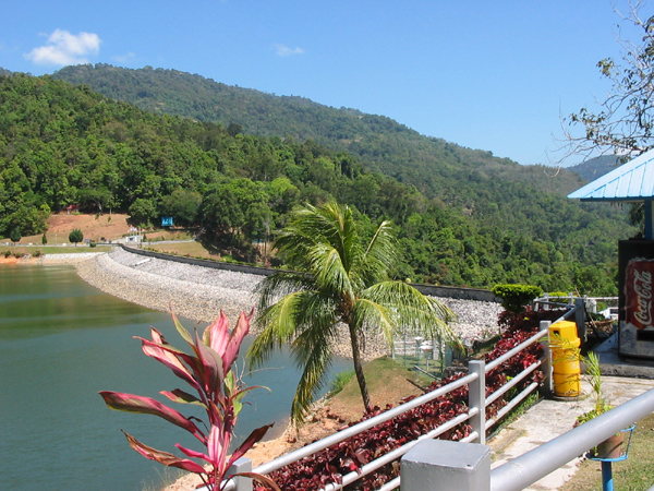
Finding maps of the Penang trails is almost impossible - but the trails do exist! I found some references on a tourist web site to a number of trails centred on Penang Hill, and for my first adventure I headed off with running partner Tarit in search of the "Tiger Hill Trail". We were dropped by our cab driver at the Kek Lok Si temple - an imposing Buddhist pagoda with a huge Quan Yin statue that dominates the hillside. We were looking for the Air Itam Dam, our starting point, but quizzing the locals proved unhelpful..."Lake? there is no lake here" one told us. He did admit to the presence of a dam, however, and a climb through the bazaar that leads to the temple gate, then a right fork along the northern side of the temple compound brought us to the roadway heading for the dam. This was a steep climb on a hot, hard road so we hiked it, not shifting up a gear into running mode until we had spied the dam. Oh, and there was a lake after all.
The road around the lake at Air Itam is about 500m up and a little cooler than the lowlands - the road is lined on both sides by jungle so there is some shade. Forests back home in Wales are often silent places, though sometimes you are blessed with birdsong, the sound of a woodpecker etc, but here the jungle symphony was in full swing. My phone has a sound recorder so if you want to close your eyes and pretend your in the jungle, play this file. There were a few people around - coming and going on mopeds with loads strapped to the back - but mostly our senses were filled with the sights and sounds of the jungle as we toiled through the hot, humid air on the undulating road.
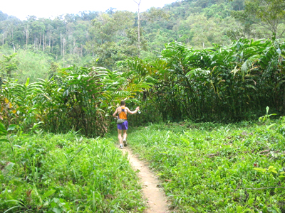
After a three-quarter circuit of the lake (clockwise from the carpark overlooking the dam) we reached a no-entry sign (though it looks as through the road simply carries on making a full loop around the lake) and here a single-track road headed steeply up into the trees. The local hash runners had obviously been here as their paper trail was still in evidence. Again we walked the climb rather than spend all our energy before we got onto the trails proper. We were both training for ultras rather than short-sharp hill races. I snapped a picture of a huge centipede but sadly my camera lost some photos when the batteries went flat so you will have to believe me when I say it was the size of my arm. Well all right, not quite. Later I saw monkeys ahead on the trail but they hid before we got to them - I could see them crouching behind the brush at the trailside watching as we passed by. There were loads of butterflies - from tiny ones to some that from a distance I thought were birds. They flew around me as I ran, showing off their colours- yellow, purple, red.... There were cascading streams close by the trail but we didn't relish the prospect of forcing our way through the undergrowth to visit them, though the prospect of dunking my hat in the cool water was enticing.
After a long climb we arrived at a crossroads, the main metalled road carrying on over a ridge and down the other side towards the western half of the island while a narrow, sandy trail crossed it. A useful signboard had been erected, obviously with the intention of housing a map, but the map had not yet been added so we got no clues there. The right turn headed up higher into the hills, so we took it, finding ourselves on a single track with a 1-foot-wide concrete strip that seemed to have been created for the use of mountain bikers (we saw the odd "mountain bike jamboree" sign stuck to a tree here and there). This trail was undulating and mostly soft underfoot so we enjoyed a good spell of steady running. When we did stop to down a gel and take some drink I took a short vid with my phone which you can see by clicking here (right click, save and play with realplayer. It's a bit lame so if you're short of time don't bother).
The trail went up, down and eventually right down into a valley with a small plantation - we passed the small house where the occupier gave us a smile and a wave as we ran right past his door. His dog was barking like crazy but must have been tied up as it didn't hassle us. The massive tree-ferns gave me the sensation of being a tiny creature running through tall grass - the vegetation was so unfamiliar that my sense of scale was turned upside down. We joined a wider path and climbed steadily back up until we eventually emerged onto the summit road that runs along the ridge of Penang Hill.
A right turn took us past the (closed) Canopy Walkway which looks like good fun, and along the ridge for several kilometres until we emerged at the hill station of Bukit Bendera, pausing only to oblige the Indian workers who wanted to have their photos taken with us. At Bukit Bendera you can cool yourself in the fountain, buy tourist souvenirs, observe the hornbills in the aviary and relax with an ice cream. We did all of these in the space of a few minutes, also wandering up the slope to the mosque and refilling our camelbaks with bottles of mineral water from one of the numerous stalls.
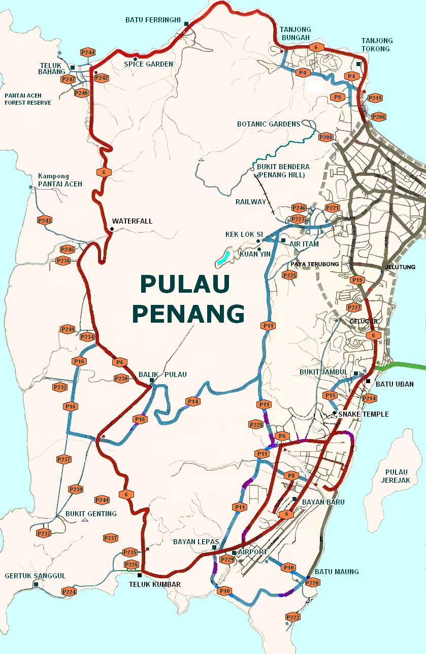
We explore the whole "village" at this end of the hill, wandering as far as the fenicular railway station, then back to the fountain where we turned right and headed down the very steep 5k of winding road to the Botanical Gardens. As we descended from around 750 metres back to the plain the temperature roase steadily and noticeably. We passed numerous walkers and a few cyclists struggling up, but no-one else seemed nuts enough to be running down - one climber warned us that "your knees will be spoiled" but Tarit seemed immune to the effects of knee-jarring descent and made a good pace down the slope which tested my tired legs. Down at the garden we found the heat intense, but there was water and fruit to be had and eventually a taxi back home. We ran and walked for well over four hours - an trip through some unfamiliar terrain which I enjoyed so much I came back to repeat it just a few days later. Heres a vague map for you - click it to visit the larger version showing Kek Lok Si, the summit road on Penang Hill and the Botanical Gardens.
Penang Hill Take 2
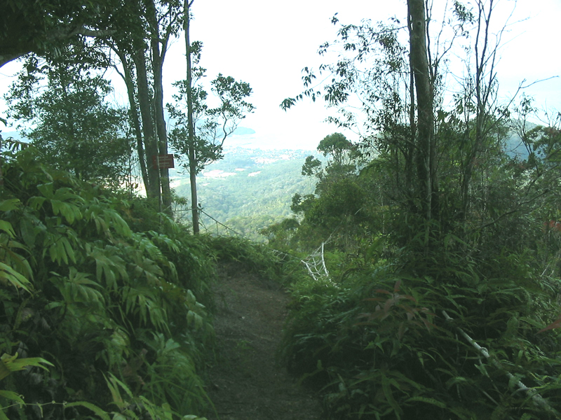
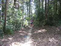
Looking north towards Teluk Bahang and Batu Ferringhi from the midpoint of the Forest Challenge Trail
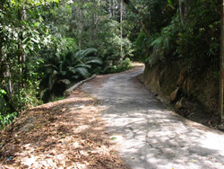
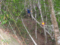
We came back with reinforcements in the shape of daulot from Seattle and Konrad from Germany. Both are handy runners, Konrad especially scared me by wearing racing flats. This time we took a cab right to the dam (we had to give a big tip to persuade the driver to cane his engine and clutch on the steep road but he did it after a little persuasion). Again we circled the lake and took the steep single-track road (wide enough for moped but only the slimmest of cars) as far as the "useless sign" before heading on to the sandy single track again.The pic below shows daulot on the lowland section just before the barking-dog-house.
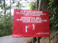
This time we again ran all the way along the summit road to Bukit Bendera to replenish water supplies and cool off before doubling back towards the other end of the ridge - Western Hill. We reached our first objective - the start of the Penang Hill Forest Challenge trail, just before we reached the highest point so we headed straight on past to visit the top. This proved an abortive exercise in pointless peak bagging, as the top of Western Hill is private and the sign (showing a gunman and his dying victim) did not exactly invite us to drop in for a visit.
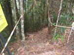
Back we went to the head of the Forest Challeng trail, which began with a roped stairway down into the forest. It carried on in that vein for some miles, steep ups and downs making most of it non-runnable but a good workout nonetheless. Igot the impression that few had passed along that trail in recent times - I later heard it's a new creation and the ropes certainly looked as if they hadn't been in place long.
One thing that amused me was the signage on the trail - at first it said 6.6 km to Teluk Bahang, then after 2k it said 4.6 to Teluk Bahang, 2km back to Penang Hill. Later the distances increases - 5km to Teluk Bahang, 6 back to Penang Hill, and so on until the total was about 12.5km - a bit of time-space dilation was going on, somewhat too Einsteinian for me, but I was enjoying the trail so no matter.
At last we came out into more open country and got a view right up to the north coast of Penang.
From here it was all runnable, and our tired legs carried us the last few km into the forest park of Teluk Bahang where we joined the signed circuit around various "stations" in the jungle which led finally to the park headquarters and cool cans of 100Plus-Isotonic Drink and ice creams.
The locals were relaxing with a swim in the river, and we left daulot here to get hold of a taxi while the remaining three carried on to clock up a few bonus miles on the road. We didn't get far before we realised there was a good chance we would be hard to find when daulot came looking for us in the cab, so we turned and ran back, meeting him just outside the Forest Park. We'd been on our feet for the best part of 5 hours, enjoying what the Pythons might call "something completely different".